Bild 1 von 10


Galerie
Bild 1 von 10


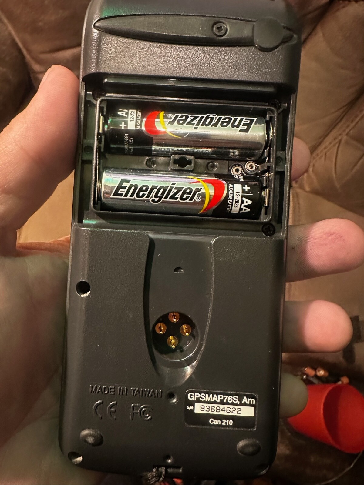

Garmin GPS Map76S mit Gurt
US $47,99
Ca.CHF 39,23
Bisher US $59,99 (- 20%)
Artikelzustand:
“Pre owned in great working condition. Unit only comes with what you see in pics.”
Gebraucht
Artikel wurde bereits benutzt. Ein Artikel mit Abnutzungsspuren, aber in gutem Zustand und vollkommen funktionsfähig. Bei dem Artikel handelt es sich unter Umständen um ein Vorführmodell oder um einen Artikel, der an den Verkäufer nach Gebrauch zurückgegeben wurde. Weitere Einzelheiten, z. B. genaue Beschreibung etwaiger Fehler oder Mängel im Angebot des Verkäufers.
- Sofort-KaufenGarmin GPS Map76S mit Gurt
Oops! Looks like we're having trouble connecting to our server.
Refresh your browser window to try again.
Versand:
US $9,00 (ca. CHF 7,36) USPS Ground Advantage®.
Standort: Logan, Utah, USA
Lieferung:
Lieferung zwischen Do, 5. Jun und Mo, 9. Jun nach 94104 bei heutigem Zahlungseingang
Rücknahme:
30 Tage Rückgabe. Verkäufer zahlt Rückversand.
Zahlungen:
Sicher einkaufen
Der Verkäufer ist für dieses Angebot verantwortlich.
eBay-Artikelnr.:177132959724
Artikelmerkmale
- Artikelzustand
- Gebraucht
- Hinweise des Verkäufers
- “Pre owned in great working condition. Unit only comes with what you see in pics.”
- Display Resolution
- Unknown
- Screen Size
- 2.5"
- Power Source
- Batteries
- Color
- Gray
- Measurement System
- Unknown
- Material
- Plastic
- Item Length
- 6"
- Personalize
- No
- Type
- Handheld/Outdoors
- Measurement Provided
- Direction
- Language
- English
- Manufacturer Warranty
- NA
- Item Height
- 1"
- Unit Size
- Not Applicable
- Sensors
- Compass
- Country/Region of Manufacture
- United States
- Sport/Activity
- Hiking
- Item Width
- 2.5"
- Item Weight
- Unknown
- UPC
- 0753759032029
Über dieses Produkt
Product Information
Get your bearings right wherever you are with the handheld Garmin GPSMAP 76S. The Garmin GPS 76S is a basic and functional handheld GPS unit. If you’re an intrepid traveler in need of basic direction for your latest outdoor or marine adventure, the Garmin GPSMAP may be a good choice. The GPSMAP 76S is a unit designed to provide precise GPS positioning using correction data obtained from the Wide Area Augmentation System (WAAS). This unit features a built-in quad helix antenna for superior reception and can provide position map accuracy to less than three meters when receiving WAAS corrections. Departing in some ways from Garmin’s earlier version of GPS units, this unit is roughly double the size of the 2.8-inch display. The device’s buttons are positioned above the screen rather than below (as in earlier models). This means you use the buttons from the side rather than the bottom. Otherwise, the Garmin GPSMAP 76S retains the basic button layout of Garmin’s other buttoned handheld GPS units: a seven-button layout with a four-way navigational pad. Some of these buttons are context sensitive, but regular users of Garmin GPS units will already be accustomed to this. The Garmin GPSMAP 76S adds an Americas, European, or Pacific basemap and 8 megabytes (MB) of map storage space to the other features of earlier models of the 76-series navigators. In addition to a pre-loaded basemap of cities, the Garmin GPS 76 includes maps for coastlines, lakes, rivers, interstates and interstate exit information, and a database of nautical navaids. The unit has eight megabytes of internal user memory for storing optional MapSource detailed maps, including marine cartography. If you’re into boating, hunting, or fishing, you can use the GPSMAP 76’s built-in celestial data, which includes tide information, sunrise and sunset times, and a hunting and fishing calendar. An extra-large display, measuring 1.6 by 2.2 inches, gives users a clear view of information, while a waterproof case means that the GPSMAP 76S Handheld will keep working well, even if it’s been submerged in water. This unit also floats in case of accidental dropping in water. The GPSMAP 76 boasts a larger display than the popular eTrex series and can be used with an external antenna for greater convenience in awkward viewing situations as well as for improved reception in poor signal locations. A large numbers option allows for easy viewing at a distance, and the backlit display and keypad simplifies use in low light situations. The GPSMAP 76 has 10,000 track points in its active track log. It can also store 10 reduced tracklogs that can have up to 250 data points. These 250 saved trackpoints can be converted to up to 50 TrackBack points. The trip computer on the GPSMAP 76 is able to display up to nine data fields at a time, including elevation, accuracy, bearing, depth, distance to destination, time to next, trip odometer, waypoints, and various other pieces of information about your routes that are explained in detail in the user manual. The unit itself weighs 7.7 oz with 2 AA batteries (not included) and has a battery life of 16 hours. Various accessories are also available (for USA and other versions) separately as well as Garmin’s own suite of software.
Product Identifiers
Brand
Garmin
MPN
010-00271-00
UPC
0753759032029
Model
GPSMAP 76S
eBay Product ID (ePID)
71234142
Product Key Features
Battery Life
16h
Display Size
1.6x2.2in
Features
Barometer, Built-In Barometer, Waypoint Icons, Compass
Dimensions
Weight
0.48lb.
Depth
1.2in
Height
6.2in
Width
2.7in
Additional Product Features
Battery Type and Quantity
2X AA Batteries
Environmental Protection
Ipx7 Waterproof Standard, High Impact Plastic Alloy Body
Blue Features
Mob (Man over Board), Depth Display, Fishing Calcluator
Number of Channels
12 Channels
Display Type
4 Level Grayscale LCD Display
Trip Calculator
Time of Sunrise/Sunset, Trip Timers, Track Log, Maximum Speed, Current Speed, Moving Average, Route Recalculation
Waas Position Accuracy
< 9.84ft.
User Interface
Keypad
Installed Memory
24MB
Antenna Type
External Antenna Hook Up, Quadrifilar Helix, Built-In
Accuisition Time-Hot
15 Sec
Accuisition Time-Initial Time
15 Sec
Map Capabilities
Download Maps, Internal
Accuisition Time-Cold
45 Sec
Grids
Lat/Lon
Resolutions
240x180
PC Interface
Serial RS-232, Nmea-0183
Unit Size
Not Applicable
Usage
Handheld/Outdoors
Update Rate
1 Per Second, Continuous
Screen Size
2.7in
Audible Features
Shallow/Deep Alarm, Anchor Alarm, Proximity Alarm, Off-Course Alarm, Arrival Alarm
System Type
Handheld
Max. Horizontal Accuracy
< 49.21ft.
Waas Features
Waas Enabled
Type
Handheld/Outdoors
Artikelbeschreibung des Verkäufers
Info zu diesem Verkäufer

FreeFormRockart
100% positive Bewertungen•4.5 Tsd. Artikel verkauft
Angemeldet als gewerblicher Verkäufer
Verkäuferbewertungen (1'150)
- a***h (130)- Bewertung vom Käufer.Letzter MonatBestätigter KaufCame as described
- m***k (1)- Bewertung vom Käufer.Letzter MonatBestätigter KaufNicely packaged and fast!
- m***k (1)- Bewertung vom Käufer.Letzter MonatBestätigter KaufReplaced my battery with a new one since the original didn’t hold a charge. I was confused at first, but they quickly explained everything. Super fast, clear, and professional service. Everything works great now and I will buy from them again!
Noch mehr entdecken:
- Garmin GPS & Sportuhren,
- Garmin Fahrradcomputer mit GPS,
- Garmin Fischfinder & GPS,
- Garmin Fahrradcomputers und GPS,
- Garmin GPS & Sportuhren mit Uhr,
- Garmin GPS & Sportuhren Entfernung,
- Garmin GPS & Sportuhren Geschwindigkeit,
- Garmin GPS & Kompasse Outdoor-Geräte,
- Garmin GPS & Sportuhren mit Timer,
- Garmin GPS & Sportuhren Fitnessstudio- & - Training
FreeFormRockart
100% positive Bewertungen•4.5 Tsd. Artikel verkauft
Angemeldet als gewerblicher Verkäufer
Verkäuferbewertungen (1'150)
- a***h (130)- Bewertung vom Käufer.Letzter MonatBestätigter KaufCame as described
- m***k (1)- Bewertung vom Käufer.Letzter MonatBestätigter KaufNicely packaged and fast!
- m***k (1)- Bewertung vom Käufer.Letzter MonatBestätigter KaufReplaced my battery with a new one since the original didn’t hold a charge. I was confused at first, but they quickly explained everything. Super fast, clear, and professional service. Everything works great now and I will buy from them again!