Bild 1 von 18


Galerie
Bild 1 von 18


Ähnlichen Artikel verkaufen?
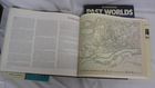
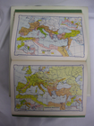
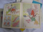
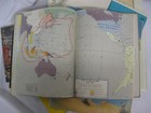
Kartographie Historische Karten Kartenherstell

US $49,97
Ca.CHF 40,72
Artikelzustand:
“Please read the full description and view the photos.”
Sehr gut
Buch, das nicht neu aussieht und gelesen wurde, sich aber in einem hervorragenden Zustand befindet. Der Einband weist keine offensichtlichen Beschädigungen auf. Bei gebundenen Büchern ist der Schutzumschlag vorhanden (sofern zutreffend). Alle Seiten sind vollständig vorhanden, es gibt keine zerknitterten oder eingerissenen Seiten und im Text oder im Randbereich wurden keine Unterstreichungen, Markierungen oder Notizen vorgenommen. Der Inneneinband kann minimale Gebrauchsspuren aufweisen. Minimale Gebrauchsspuren. Genauere Einzelheiten sowie eine Beschreibung eventueller Mängel entnehmen Sie bitte dem Angebot des Verkäufers.
- Sofort-KaufenKartographie Historische Karten Kartenherstellung 10 Bücher Lot Atlas Antike Moderne
Oops! Looks like we're having trouble connecting to our server.
Refresh your browser window to try again.
Abholung:
Kostenlose Abholung in Denver, Colorado, USA.
Versand:
US $18,72 (ca. CHF 15,25) USPS Media MailTM.
Standort: Denver, Colorado, USA
Lieferung:
Lieferung zwischen Sa, 2. Aug und Mi, 6. Aug nach 94104 bei heutigem Zahlungseingang
Versand heute bei Bestellung innerhalb der nächsten 10 Std 1 Min
Rücknahme:
30 Tage Rückgabe. Käufer zahlt Rückversand. Wenn Sie ein eBay-Versandetikett verwenden, werden die Kosten dafür von Ihrer Rückerstattung abgezogen.
Zahlungen:
Sicher einkaufen
Der Verkäufer ist für dieses Angebot verantwortlich.
eBay-Artikelnr.:205605213244
Artikelmerkmale
- Artikelzustand
- Sehr gut
- Hinweise des Verkäufers
- “Please read the full description and view the photos.”
- ISBN
- 9781780239293
Über dieses Produkt
Product Identifiers
Publisher
Reaktion Books, The Limited
ISBN-10
1780239297
ISBN-13
9781780239293
eBay Product ID (ePID)
239732326
Product Key Features
Book Title
Trading Territories : Mapping the Early Modern World
Number of Pages
208 Pages
Language
English
Topic
Cartography, Historical Geography, General, Expeditions & Discoveries
Publication Year
2019
Illustrator
Yes
Genre
Technology & Engineering, History
Format
Trade Paperback
Dimensions
Item Height
0.9 in
Item Length
7.7 in
Item Width
5 in
Additional Product Features
Intended Audience
Trade
Dewey Edition
21
Reviews
In this outstanding study of maps and mapping, Brotton reveals a dynamism in the transaction between East and West beyond anything we have previously appreciated., A beautifully illustrated account of the status, construction and purposes of maps in the early modern world., Brotton's elegant Trading Territories shows how historically maps were about facilitating trade and celebrating (and exerting) influence., Brotton's Trading Territories is a history not just of how the first truly global maps were made but how they were conceptualized, and how they shaped as well as described the earlymodern world. . . . Trading Territories covers a wide sweep of shifting territory with verve and authority.
Dewey Decimal
912/.09
Synopsis
Trading Territories tells the compelling story of maps and geographical knowledge in the early modern world from the fifteenth to the early seventeenth century. Examining how European geographers mapped the territories of the Old World--Africa and Southeast Asia--this book shows how the historical preoccupation with Columbus's "discovery" of the New World of America in 1492 obscured the ongoing importance of mapping territories that have since been defined as "Eastern," especially those in the Muslim world. In this book, now available in its second edition and updated with a new preface by the author, Jerry Brotton shows that trade and diplomacy defined the development of maps and globes in this period, far more than the disinterested pursuit of scientific accuracy and objectivity, and challenges our preconceptions about not just maps, but also the history and geography of what we call East and West., Trading Territories tells the compelling story of maps and geographical knowledge in the early modern world from the fifteenth to the early seventeenth century. Examining how European geographers mapped the territories of the Old World - Africa and Southeast Asia - this book shows how the historical preoccupation with Columbus's 'discovery' of the New World of America in 1492 obscured the ongoing importance of mapping territories that have since been defined as 'eastern', especially those in the Muslim world. In this book, now available in paperback and updated with a new preface by the author, Jerry Brotton shows that trade and diplomacy defined the development of maps and globes in this period, far more than the disinterested pursuit of scientific accuracy and objectivity, and challenges our preconceptions about not just maps, but also the history and geography of what we call East and West.
LC Classification Number
GA201
Artikelbeschreibung des Verkäufers
Info zu diesem Verkäufer

Tom The Book Guy
100% positive Bewertungen•20 Tsd. Artikel verkauft
Angemeldet als privater VerkäuferDaher finden verbraucherschützende Vorschriften, die sich aus dem EU-Verbraucherrecht ergeben, keine Anwendung. Der eBay-Käuferschutz gilt dennoch für die meisten Käufe.
Verkäuferbewertungen (10'176)
- e***d (49)- Bewertung vom Käufer.Letzter MonatBestätigter KaufGreat
- 2***h (2608)- Bewertung vom Käufer.Letzter MonatBestätigter Kaufthanks
- 5***5 (918)- Bewertung vom Käufer.Letzter MonatBestätigter KaufGreat item. Condition as described and pictured. Fast shipping. Secure packaging.
Noch mehr entdecken:
- Historische-Literatur-Moderne-Belletristik - Bücher,
- Moderne Belletristik-Bücher,
- Historische Literatur Belletristik-Bücher,
- Moderne Erwachsene Belletristik-Bücher,
- Moderne Abenteuer Belletristik-Bücher,
- Moderne Literatur Bücher Belletristik,
- Moderne Bücher Thriller Belletristik,
- Moderne Bücher Freundschaft Belletristik,
- Moderne Bücher Spionage Belletristik,
- Krimis- & - Thriller-Moderne-Belletristik-Bücher
Tom The Book Guy
100% positive Bewertungen•20 Tsd. Artikel verkauft
Angemeldet als privater VerkäuferDaher finden verbraucherschützende Vorschriften, die sich aus dem EU-Verbraucherrecht ergeben, keine Anwendung. Der eBay-Käuferschutz gilt dennoch für die meisten Käufe.
Verkäuferbewertungen (10'176)
- e***d (49)- Bewertung vom Käufer.Letzter MonatBestätigter KaufGreat
- 2***h (2608)- Bewertung vom Käufer.Letzter MonatBestätigter Kaufthanks
- 5***5 (918)- Bewertung vom Käufer.Letzter MonatBestätigter KaufGreat item. Condition as described and pictured. Fast shipping. Secure packaging.